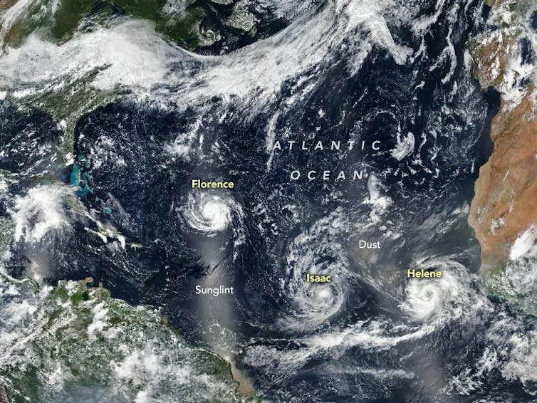
Melting glaciers, rising sea levels, global warming and violent storms: the effects of climate change are well documented. But a growing weather trend that has caused much concern is storm clustering – when three (sometimes more) hurricanes or typhoons group together in a short space of time, gathering strength and unleashing even greater devastation.
The development of a tropical depression – a low pressure area with thunderstorms and winds below 39mph – to a tropical storm that attains hurricane strength in less than six hours, shows how quickly these things can intensify.
But increased frequency is also a trend, as storms follow each other in quick succession. Those who question the existence of climate change should look at the global hurricane history, or even the hurricane pattern in their own country. If we look at these storms, patterns of increasing intensity and frequency clearly demonstrate how climate change is having a direct impact on the way hurricanes behave.


In developed countries coastal residents in affected areas are keenly aware of these hazards and respond well during emergencies by liaising with local agencies and heading to designated shelters during evacuations. But this is not the case in developing and underdeveloped countries, although basic response awareness exists through devastating experience and a degree of public information.
Predicting the big ones
Thanks to advances in hurricane forecasting and hindcasting techniques, situations like the Galveston hurricane in 1900, which struck the Texas coast without any official warnings, are happily a thing of the past.
The weather prediction models of the National Hurricane Center and the European Centre for Medium Range Weather Forecasting are able to plot the likelihood of impending hurricane paths – known as the “cone of uncertainty” – five days in advance, and are generally accurate.
But the real issue is how prepared we are around the world for the increasing frequency of hurricanes and their terrifying “gang” version, hurricane trios. This violent onslaught of hurricane-strength storms batters communities and destroys buildings and infrastructure from the US to the Caribbean to South-East Asia. But should communities on the coast stay and defend, or retreat altogether?

Hurricane season
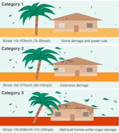
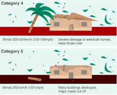
Hurricanes hammered the Atlantic from 2016 and 2018, including the Category 5 Matthew (2016), the Harvey-Irma-Maria trio (2017), which registered Category 4, 5 and 4 respectively, and Category 4 Florence and Michael (2018). This not only revealed the rising trend in intensity and frequency, but also alerted the world to the phenomena of clustering.
Critically, predicting the path of a hurricane depends on forecasting the dynamics of its intensity. Understanding the factors that contribute to the sudden changes in the strength (or weakening) of a hurricane is crucial. Changes in wind direction, interaction with the land at the coast, and ocean temperature and depth all play their part in altering the intensity of a hurricane that is highly sensitive to even slight changes.
In general, the accuracy of predicting the way a hurricane intensifies and then re-intensifies in less than 24 hours is more challenging than predicting its path. But these dynamics are the underlying factors which compound the threat of hurricane frequency. These dynamics are also capable of further altering storm surge characteristics by triggering coastal and inland flooding – such as abnormal rises in water levels – which often result in shocking devastation.
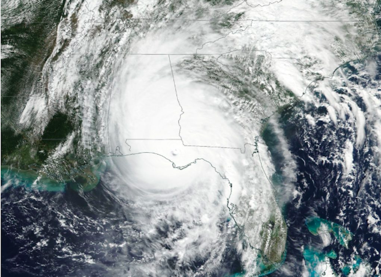
Hurricane Michael in 2018 was the perfect example of the importance of predicting how rapidly a hurricane has intensified before it hits the coast, in this case Florida. The predicted track of the storm was almost accurate but its intensity was more difficult to assess.
The National Hurricane Center forecasted Michael’s path by issuing a five-day cone of uncertainty advising of sustained winds of 65mph. However, the sudden change in the storm’s dynamics changed a Category 1 hurricane to a Category 4 with winds of 155mph. This underscores the uncertain and variable nature of hurricane prediction.

Building on sand
Despite these emerging and changing weather-related risks, residential and public buildings are still going up on affected coastal areas. Recent research in China identified a tsunami that swept away the present-day coastal province of Guangdong in 1076AD. It means storm-related surges have been documented in the region for more than 1,000 years – yet still building and expansion goes on heedless of the risk.
This is almost the same situation for all vulnerable coastal cities. For instance, Florida has hundreds of thousands of coastal residents living in Low Elevation Coastal Zones – land that is less than 10 metres above sea level and within 200km of the coast – but yet again construction there continues despite the threat of hurricanes every season.
Developers are already conceiving storm-resilient buildings that can withstand winds of at least 200mph – a Category 5 hurricane. But it’s unlikely many have considered the compounded stress effect on structures having to continuously withstand hurricane force winds more frequently and in quick succession.
Building massive sea defences along vulnerable coastlines is practically impossible and isn’t a permanent solution to increasing coastal storm hazards. There is no point in risking lives by remaining, as storm clusters can be unpredictable. It is simply too dangerous, so evacuation is the only option. However, when it comes to coastal assets and investments, defending in a more appropriate and sensible way is required.
Some coastal cities are planning ahead. A recent development of extensive parks in Boston, US, aims to protect the urban shoreline infrastructure from flooding. And a 2009 study revealed the effectiveness of mangrove planting in coastal areas of India to protect the shoreline and reduce cyclone damage. But more practical solutions are needed, especially in more vulnerable developing regions, because cluster storms are not going away any time soon.![]()
Anitha Karthik, Doctoral Researcher, Edinburgh Napier University
This article is republished from The Conversation under a Creative Commons license. Read the original article.
Independent journalism costs money. Support Times of Malta for the price of a coffee.
Support Us