Not sure where to park? This website could help
Malta Resident Parking website, developed by Jonathan Bernard Pace, offers street-specific parking information to users
A new website could help motorists avoid getting slapped with a parking fine, providing a map of restricted parking areas in different localities across the country.
The Malta Resident Parking website allows users to view a map of Malta’s roads showing on-street resident parking, paid car parks and park and ride locations across parts of Malta and Gozo.
Users can filter the results by locality and parking type, with streets changing colour based on where they live; restricted roads are shown in orange, changing to green to indicate resident parking when a user selects their locality.
The website is the brainchild of software developer Jonathan Bernard Pace, who said he was inspired to create the site “after receiving more parking tickets than I’d like to admit”.
“I got one too many tickets if I’m being honest,” he said. “But I couldn’t find a centralised place to find information about parking, and with my background in tech, I thought it couldn’t be that hard.”
It took Pace around two and a half weeks to build the website, working on the project in the evenings.
“Now I have a tool I can share with everyone – I love building things, and I gain nothing from keeping it to myself,” he said, while acknowledging there were still some bugs to iron out.
Resident parking remains a common source of confusion for many drivers and residents across Malta, he said.
The developer built the website using free, open-source mapping data as an alternative to paid options like Google Maps, which he said would have made offering the website for free more difficult.
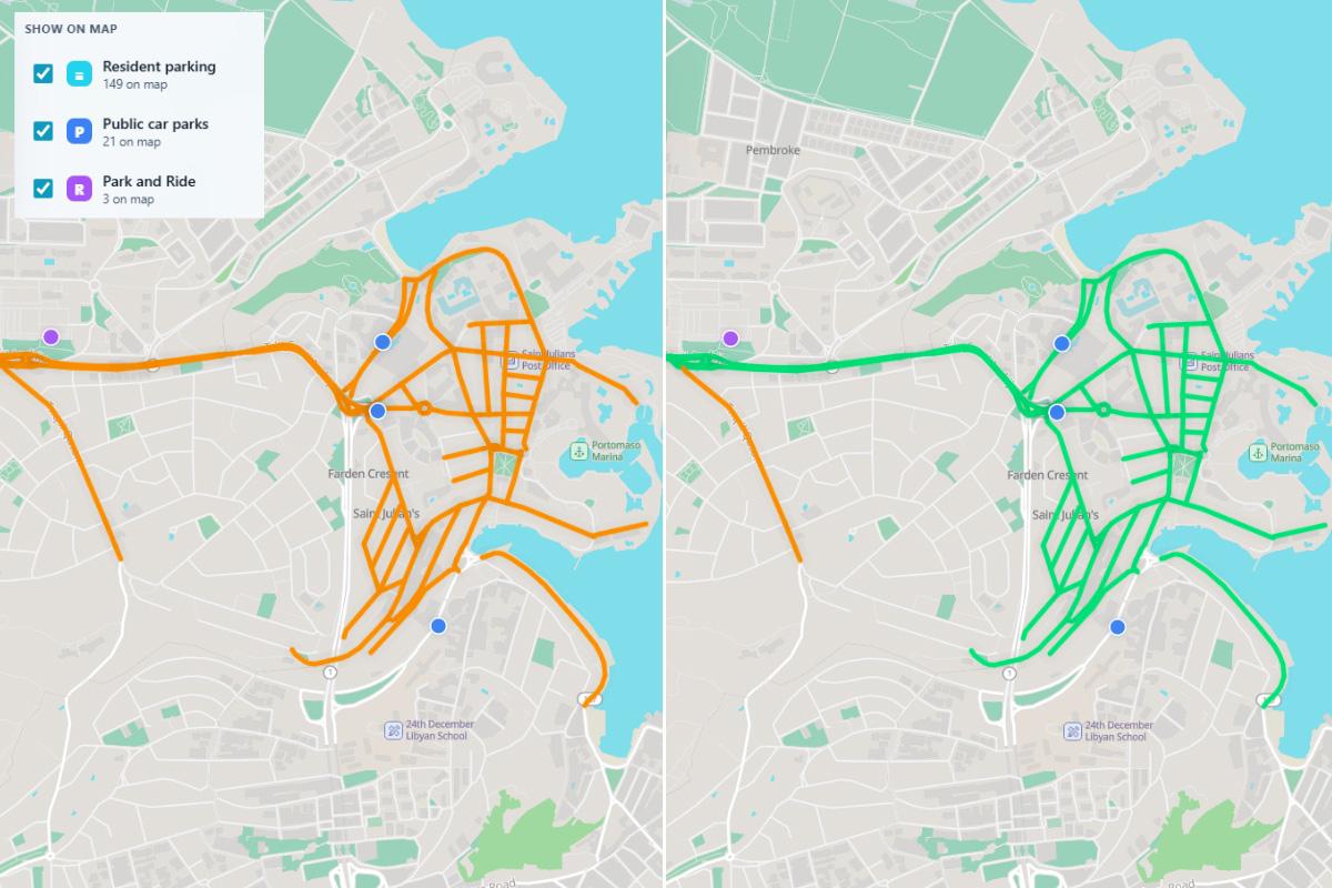 Roads change colour from orange to green to indicate available parking when a resident filters by locality.
Pace noted that while free, the mapping data was relatively up to date, including diversions around the Msida Creek project.
He said he intends to keep the service free indefinitely and would likely introduce a small number of adverts at some point in the future to keep the site financially self-sustaining.
The developer added that building the website had brought home to him how concentrated parking provision was in areas like Sliema and St Julian’s.
“I simply found the information difficult to access in a clear visual format and thought others might benefit from having it available on a map,” he said.
The project is still evolving, and Bernard Pace recently added public transport routes, cycling routes and facilities including EV charging points, public toilets, police stations, hospitals, pharmacies and government buildings.
This is not the first time a private citizen has been inspired to use technology to help the public understand public information.
In 2023, software developer and bicycle advocate Daniel Vella launched pollution.mt, now arja.mt, which compares government air quality data with health guidelines.
And in 2024, UK-based Maltese software developer David Vella brought the building construction frenzy that has enveloped the country to life in a video showing the evolution in the number of planning applications approved and rejected since 1993.